Arms trade to Burundi
A map of the trade corridors, international arms exports and recent conflict time-line
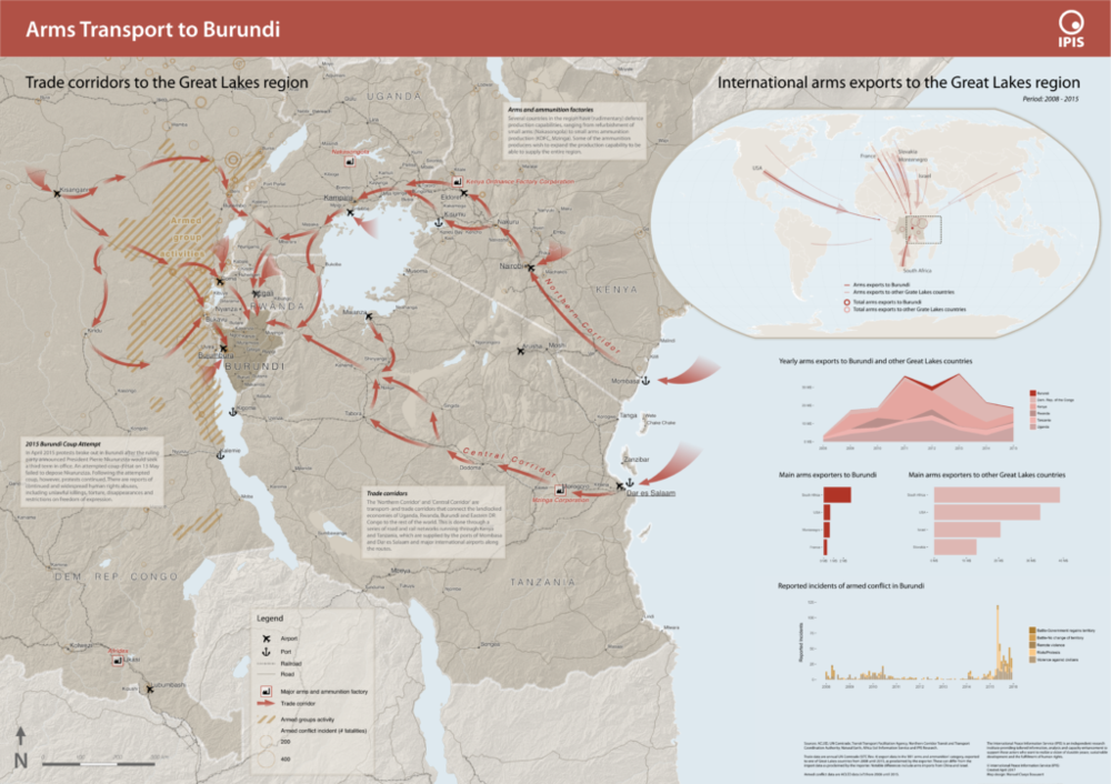
Burundi had seen a period of unrest following the failed coup d’état by a Burundian general in May 2015. In order to better understand the situation, IPIS drafted a new map entitled ‘Arms transport to Burundi’, which puts the 2015 unrest in the geographical perspective of the Great Lakes region and in the relevant time-frame covering 2008 to 2015. The map highlights two important factors in the recent conflict: the role and power of the army, and the reported incidents of armed conflict.
This map was entirely made using Open Source tools (QGIS) and Open Data!
— @ IPIS, 2017